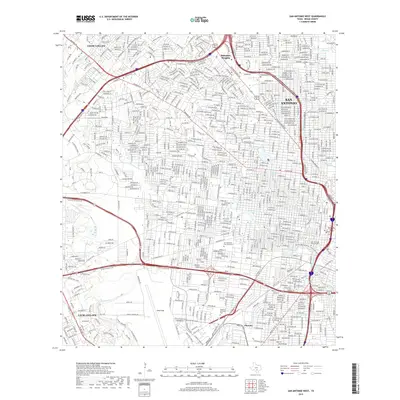
2019 Map of San Antonio West
USGS Topo · Published 2019About this map
Kelly Field and Lackland AFB anchor the southwestern portion of this metropolitan landscape, illustrating the enduring military aviation presence in western San Antonio. The urban grid is defined by major transit arteries like Bandera Rd and the NW Loop 410 arc, which connect the independent enclaves of Leon Valley and Balcones Heights to the city center.
Find a feature on this map
30 named features on this map. Tap any name to fly to it.
Don’t see what you’re looking for? This feature index may not catch every label — zoom into the map to look around manually.
Map Details
Editions of this 2019 San Antonio West Map
This is the sole edition of this map. No revisions or reprints were ever made.
Other maps of this area

1953 · Culebra Hill
USGS Topo · 1:24,000

1953 · San Antonio West
USGS Topo · 1:24,000

1953 · San Antonio East
USGS Topo · 1:24,000

1953 · Terrell Wells
USGS Topo · 1:24,000

1953 · Longhorn
USGS Topo · 1:24,000

1953 · Macdona
USGS Topo · 1:24,000

1953 · Southton
USGS Topo · 1:24,000

1953 · Helotes
USGS Topo · 1:24,000

1953 · Castle Hills
USGS Topo · 1:24,000

1954 · San Antonio
USGS Topo · 1:250,000