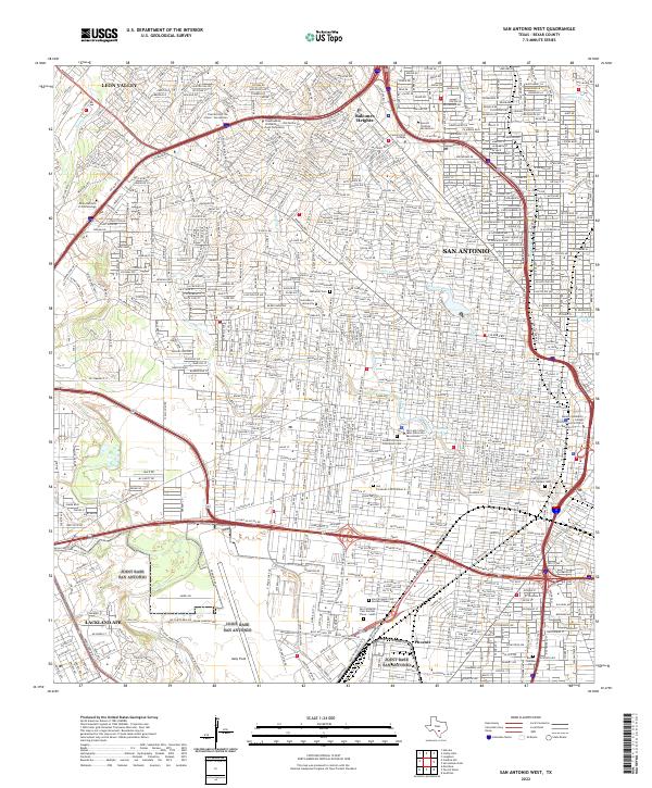
2022 Map of San Antonio West
USGS Topo · Published 2022About this map
San Antonio's western urban landscape is defined here by a dense concentration of civic, educational, and religious institutions. This 2022 survey captures the sprawling campus of Saint Mary's University and Our Lady of the Lake University, the latter overlooking the waters of Elmendorf Lake. The area's genealogical and cultural history is deeply anchored in a series of major burial grounds, including San Fernando Cem Number One and the expansive San Fernando Cem Number 2.
Find a feature on this map
34 named features on this map. Tap any name to fly to it.
Don’t see what you’re looking for? This feature index may not catch every label — zoom into the map to look around manually.
Map Details
Editions of this 2022 San Antonio West Map
This is the sole edition of this map. No revisions or reprints were ever made.
Other maps of this area

1953 · Culebra Hill
USGS Topo · 1:24,000

1953 · San Antonio West
USGS Topo · 1:24,000

1953 · San Antonio East
USGS Topo · 1:24,000

1953 · Terrell Wells
USGS Topo · 1:24,000

1953 · Longhorn
USGS Topo · 1:24,000

1953 · Macdona
USGS Topo · 1:24,000

1953 · Southton
USGS Topo · 1:24,000

1953 · Helotes
USGS Topo · 1:24,000

1953 · Castle Hills
USGS Topo · 1:24,000

1954 · San Antonio
USGS Topo · 1:250,000