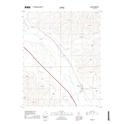
2018 Map of San Ardo
USGS Topo · Published 2018About this map
The Salinas River carves a central path through this landscape, separating the rising slopes of the Santa Lucia Range to the west from the Diablo Range to the east. The settlement of San Ardo serves as the focal point for this portion of Monterey County, situated near the confluence of the river and Pancho Rico Cr. The surrounding terrain is defined by a network of drainage canyons and gulches, including Garrissere Canyon, Casey Gulch, and Jim Lawson Gulch.
Find a feature on this map
37 named features on this map. Tap any name to fly to it.
Don’t see what you’re looking for? This feature index may not catch every label — zoom into the map to look around manually.
Map Details
Editions of this 2018 San Ardo Map
This is the sole edition of this map. No revisions or reprints were ever made.
Other maps of this area

1912 · San Ardo
USGS Topo · 1:31,680

1915 · Priest Valley
USGS Topo · 1:125,000

1919 · King City
USGS Topo · 1:62,500

1919 · Bryson
USGS Topo · 1:62,500

1919 · Bradley
USGS Topo · 1:62,500

1939 · King City
USGS Topo · 1:62,500

1941 · San Ardo
USGS Topo · 1:62,500

1941 · Bradley
USGS Topo · 1:62,500

1941 · Bryson
USGS Topo · 1:62,500

1942 · Bryson
USGS Topo · 1:62,500