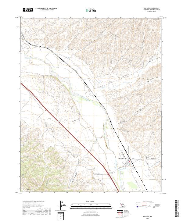
2021 Map of San Ardo
USGS Topo · Published 2021About this map
San Ardo serves as the focal point of this Monterey County landscape, positioned where the valley floor meets the rising slopes of the Santa Lucia Range and the Diablo Range. The Salinas River carves through the center of the sheet, flanked by the sprawling San Ardo Field, a significant marker of the region's energy history. The map detail highlights the transition from the river's riparian corridor to the complex canyon systems of Paris Valley and Pancho Rico Valley. Local transport and agricultural arteries, including Cattlemen Rd and Paris Valley Rd, follow the natural contours of the terrain, providing a look at the infrastructure supporting the area's ranching and oil production legacy. The naming of features like Jim Lawson Gulch and Garrissere Canyon points to the family histories and settlement patterns that shaped this section of the Salinas Valley.
Find a feature on this map
35 named features on this map. Tap any name to fly to it.
Don’t see what you’re looking for? This feature index may not catch every label — zoom into the map to look around manually.
Map Details
Editions of this 2021 San Ardo Map
This is the sole edition of this map. No revisions or reprints were ever made.
Other maps of this area

1912 · San Ardo
USGS Topo · 1:31,680

1915 · Priest Valley
USGS Topo · 1:125,000

1919 · King City
USGS Topo · 1:62,500

1919 · Bryson
USGS Topo · 1:62,500

1919 · Bradley
USGS Topo · 1:62,500

1939 · King City
USGS Topo · 1:62,500

1941 · San Ardo
USGS Topo · 1:62,500

1941 · Bradley
USGS Topo · 1:62,500

1941 · Bryson
USGS Topo · 1:62,500

1942 · Bryson
USGS Topo · 1:62,500