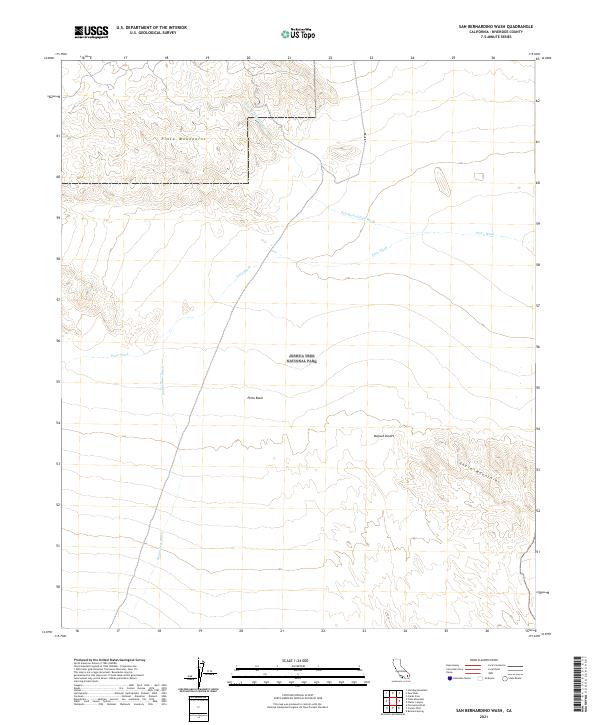
2021 Map of San Bernardino Wash
USGS Topo · Published 2021About this map
Joshua Tree National Park encompasses a significant portion of this landscape, where the southern reaches of the Mojave Desert meet a complex network of dry desert drainage systems. The map shows the vast Pinto Basin framed by the prominent Pinto Mountains to the north and the Eagle Mountains to the southeast. This terrain is characterized by its ephemeral hydrology, defined by the extensive paths of the San Bernardino Wash, Pinto Wash, and Smoke Tree Wash. These features highlight the natural corridors through which seasonal waters move across the basin floor, shaping the arid geography and influencing the location of native flora. The grid of the Public Land Survey System overlays these features, marking sections across the desert expanse within Riverside County.
Find a feature on this map
12 named features on this map. Tap any name to fly to it.
Don’t see what you’re looking for? This feature index may not catch every label — zoom into the map to look around manually.
Map Details
Editions of this 2021 San Bernardino Wash Map
This is the sole edition of this map. No revisions or reprints were ever made.
Other maps of this area

1942 · Amboy
USGS Topo · 1:250,000

1943 · Amboy
USGS Topo · 1:250,000

1943 · Pinkham Well
USGS Topo · 1:62,500

1944 · Pinkham Well
USGS Topo · 1:62,500

1944 · Eagle Tank
USGS Topo · 1:62,500

1954 · Salton Sea
USGS Topo · 1:250,000

1954 · Needles
USGS Topo · 1:250,000

1955 · Salton Sea
USGS Topo · 1:250,000

1956 · Needles
USGS Topo · 1:250,000

1956 · Dale Lake
USGS Topo · 1:62,500