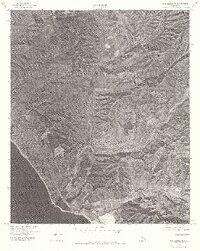
1974 Map of San Clemente
USGS Topo · Published 1977About this map
San Clemente sits on the edge of the Pacific Ocean in this mid-1970s orthophotoquad, which uses aerial photography to capture the coastal expansion and military landscape of Orange County. Large portions of the terrain are dominated by the Camp Pendleton Marine Corps Base, showing the juxtaposition between the dense residential street grids of the coastal town and the undeveloped training grounds to the south and east. The photography reveals the drainage patterns and rugged topography of the backcountry, particularly where Gabino Canyon and Talega Canyon carve through the hillsides. This visual survey provides an unfiltered look at the 1974 coastline, documenting the transition from suburban development to protected military and natural lands before the major growth of subsequent decades.
Find a feature on this map
5 named features on this map. Tap any name to fly to it.
Don’t see what you’re looking for? This feature index may not catch every label — zoom into the map to look around manually.
Map Details
Editions of this 1974 San Clemente Map
2 editions found
Other maps of this area

1901 · Southern California Sheet No. 1
USGS Topo · 1:250,000

1901 · Elsinore
USGS Topo · 1:125,000

1901 · San Luis Rey
USGS Topo · 1:125,000

1902 · Capistrano
USGS Topo · 1:125,000

1902 · Corona
USGS Topo · 1:125,000

1904 · Southern California Sheet No. 2
USGS Topo · 1:250,000

1904 · Southern California Sheet No. 1
USGS Topo · 1:250,000

1906 · Capistrano
USGS Topo · 1:125,000

1941 · Margarita Peak
USGS Topo · 1:62,500

1942 · Lake Elsinore
USGS Topo · 1:62,500
Featured Places
- San Clemente, CA
- San Juan Capistrano, CA
- Marine Corps Base Camp Pendleton, CA
- San Onofre, Marine Corps Base Camp Pendleton
- San Diego County, CA