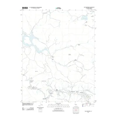
2012 Map of San Geronimo
USGS Topo · Published 2012About this map
Nicasio and its surrounding valleys anchor this survey of Marin County’s interior, where the landscape transitions from the open waters of Stafford Lake down through the wooded corridors of Redwood Canyon. The settlement pattern follows the winding course of the San Geronimo Valley, connecting Woodacre, Forest Knolls, and Lagunitas along the southern edge. The presence of Skywalker Ranch Rd north of Lucas Valley signals the modern cultural footprint on this traditionally rural ranching terrain. Significant public and recreational spaces are detailed, including Camp Taylor and the San Geronimo National Golf Course. The map also captures the intricate drainage system where Lagunitas Cr and Nicasio Cr meet, highlighting historic crossing points such as Shafter Bridge and the small siding at Jewell.
Find a feature on this map
73 named features on this map. Tap any name to fly to it.
Don’t see what you’re looking for? This feature index may not catch every label — zoom into the map to look around manually.
Map Details
Editions of this 2012 San Geronimo Map
This is the sole edition of this map. No revisions or reprints were ever made.
Other maps of this area

1897 · Tamalpais
USGS Topo · 1:62,500

1914 · Petaluma
USGS Topo · 1:62,500

1916 · Point Reyes
USGS Topo · 1:48,000

1918 · Point Reyes
USGS Topo · 1:62,500

1941 · Tamalpais
USGS Topo · 1:62,500

1942 · Petaluma
USGS Topo · 1:62,500

1947 · Santa Rosa
USGS Topo · 1:250,000

1947 · San Francisco
USGS Topo · 1:250,000

1948 · San Francisco
USGS Topo · 1:250,000

1949 · Santa Rosa
USGS Topo · 1:250,000