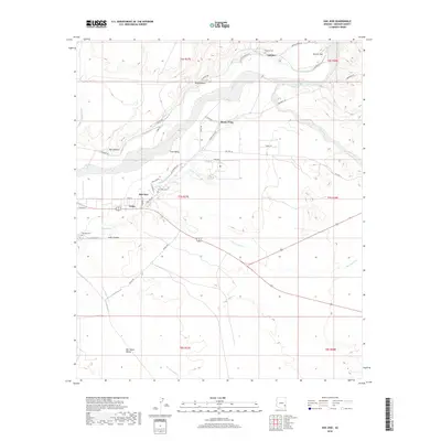
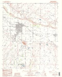
2018 Map of San Jose
USGS Topo · Published 2018About this map
The Gila River valley forms the centerpiece of this 2018 survey, where the river's path is closely shadowed by a network of essential irrigation infrastructure including the Brown Canal and San Jose Canal. These waterways have long supported the agricultural clusters of San Jose, Buena Vista, and Sanchez, located along the northern banks where the valley floor meets the slopes of Earven Flat. The map provides specific detail for local researchers, documenting family-linked sites such as the San Jose Cem, Sanchez Cem, and Solomon Cem. To the south, the landscape shifts toward the open San Simon Valley, drained by the San Simon River and several prominent washes including Bennett Wash and Judy Wash. The road network, featuring routes like Old Sanchez Rd and Old Hwy 70, reflects the historical transit corridors that linked these riverfront settlements to the broader Graham County region.
Find a feature on this map
47 named features on this map. Tap any name to fly to it.
Don’t see what you’re looking for? This feature index may not catch every label — zoom into the map to look around manually.
Map Details
Editions of this 2018 San Jose Map
This is the sole edition of this map. No revisions or reprints were ever made.
Other maps of this area

1954 · Silver City
USGS Topo · 1:250,000

1958 · Silver City
USGS Topo · 1:250,000

1960 · Guthrie
USGS Topo · 1:62,500

1960 · Safford
USGS Topo · 1:62,500

1962 · Silver City
USGS Topo · 1:250,000
1966 · Artesia NE
USGS Topo · 1:24,000

1966 · Artesia
USGS Topo · 1:24,000
1966 · Dry Mountain
USGS Topo · 1:24,000
1985 · Gila Box
USGS Topo · 1:24,000
1985 · Safford
USGS Topo · 1:24,000