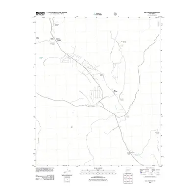
2011 Map of San Lorenzo
USGS Topo · Published 2011About this map
The Mimbres River valley defines the character of this New Mexico landscape, serving as the primary corridor for settlement and transportation. Along its course, the communities of Mimbres, San Lorenzo, and San Juan are linked by a network of winding roads like Acelin Hill Rd and Galaz St. The presence of the San Juan Historic District underscores the deep-rooted heritage of the region, while the Rose Mine and Reeds Peak Lookout Tower indicate a history of resource extraction and forest monitoring. Numerous drainages such as Noonday Canyon and Ancheta Canyon cut through the terrain, illustrating the complex hydrology that feeds into the central valley. Local roads, including the uniquely named Sherman Cementry Rd and Wigwam Ranch Rd, provide specific points of reference for genealogists and local historians tracing land use in Grant County.
Find a feature on this map
34 named features on this map. Tap any name to fly to it.
Don’t see what you’re looking for? This feature index may not catch every label — zoom into the map to look around manually.
Map Details
Editions of this 2011 San Lorenzo Map
This is the sole edition of this map. No revisions or reprints were ever made.
Other maps of this area

1909 · Silver City
USGS Topo · 1:125,000

1937 · Santa Rita
USGS Topo · 1:24,000

1947 · Allie Canyon
USGS Topo · 1:24,000

1948 · Santa Rita
USGS Topo · 1:24,000

1948 · Allie Canyon
USGS Topo · 1:24,000

1948 · Hurley East
USGS Topo · 1:24,000

1949 · Hurley East
USGS Topo · 1:24,000
1951 · Santa Rita
USGS Topo · 1:24,000

1954 · Silver City
USGS Topo · 1:250,000

1955 · Las Cruces
USGS Topo · 1:250,000