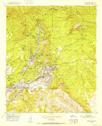
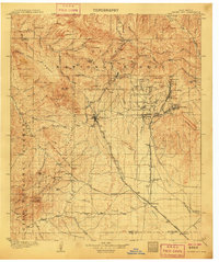
1951 Map of Santa Rita
USGS Topo · Published 1953About this map
The massive excavations of the North Pit Chino Mine and South Pit Chino Mine dominate the landscape in the early 1950s, signifying the scale of industrial mineral extraction in this part of the state. This period finds the mining town of Santa Rita tightly integrated into this industrial activity, with its rail connections via the Atchison Topeka and Santa Fe railroad and Santa Rita Station. The map records a concentration of labor and infrastructure in the surrounding settlements of Hanover, Fierro, Wimsatville, and Turnerville, where features like the Hanover Sch and numerous shafts—including the Oswaldo No 1 Shaft and Princess Shaft—indicate a bustling mining economy.
Find a feature on this map
105 named features on this map. Tap any name to fly to it.
Don’t see what you’re looking for? This feature index may not catch every label — zoom into the map to look around manually.
Map Details
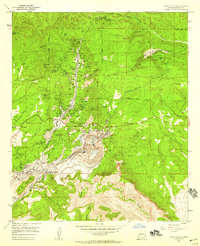
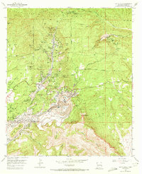
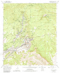
Editions of this 1951 Santa Rita Map
4 editions found
Other maps of this area
1909 · Silver City
USGS Topo · 1:125,000

1937 · Santa Rita
USGS Topo · 1:24,000
1947 · Allie Canyon
USGS Topo · 1:24,000
1947 · Twin Sisters
USGS Topo · 1:24,000

1947 · Fort Bayard
USGS Topo · 1:24,000

1948 · Twin Sisters
USGS Topo · 1:24,000

1948 · Santa Rita
USGS Topo · 1:24,000

1948 · Allie Canyon
USGS Topo · 1:24,000

1948 · Hurley East
USGS Topo · 1:24,000

1949 · Fort Bayard
USGS Topo · 1:24,000