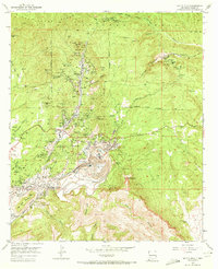
1951 Map of Santa Rita
USGS Topo · Published 1972About this map
Industrial copper and iron mining dominate this high-altitude landscape within the Gila National Forest, where massive open pits and intricate shaft networks define the local economy. At the heart of the district, the South Pit Chino Mine is surrounded by support settlements like Santa Rita, Wimsattville, and Turnerville. The geography is a complex weave of heavy industry and small-town life, with numerous schools such as Sully Sch and Union Hill Sch situated alongside massive operations like the Hanover-Bessemer Iron Pits.
Find a feature on this map
121 named features on this map. Tap any name to fly to it.
Don’t see what you’re looking for? This feature index may not catch every label — zoom into the map to look around manually.
Map Details
Editions of this 1951 Santa Rita Map
4 editions found
Other maps of this area

1909 · Silver City
USGS Topo · 1:125,000

1937 · Santa Rita
USGS Topo · 1:24,000

1947 · Allie Canyon
USGS Topo · 1:24,000

1947 · Twin Sisters
USGS Topo · 1:24,000

1947 · Fort Bayard
USGS Topo · 1:24,000

1948 · Twin Sisters
USGS Topo · 1:24,000

1948 · Santa Rita
USGS Topo · 1:24,000

1948 · Allie Canyon
USGS Topo · 1:24,000

1948 · Hurley East
USGS Topo · 1:24,000

1949 · Fort Bayard
USGS Topo · 1:24,000