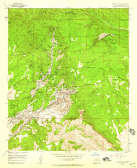
1951 Map of Santa Rita
USGS Topo · Published 1959About this map
The massive North Pit Chino Mine and South Pit Chino Mine dominate this central New Mexico landscape, illustrating the intense industrial copper mining operations of the mid-20th century. Clustered around these excavations are the worker settlements and support towns of Santa Rita, Turnerville, and Wimsattville, which contrast with the higher-elevation wilderness of the Gila National Forest to the north.
Find a feature on this map
66 named features on this map. Tap any name to fly to it.
Don’t see what you’re looking for? This feature index may not catch every label — zoom into the map to look around manually.
Map Details
Editions of this 1951 Santa Rita Map
4 editions found
Other maps of this area

1909 · Silver City
USGS Topo · 1:125,000

1937 · Santa Rita
USGS Topo · 1:24,000

1947 · Allie Canyon
USGS Topo · 1:24,000

1947 · Twin Sisters
USGS Topo · 1:24,000

1947 · Fort Bayard
USGS Topo · 1:24,000

1948 · Twin Sisters
USGS Topo · 1:24,000

1948 · Santa Rita
USGS Topo · 1:24,000

1948 · Allie Canyon
USGS Topo · 1:24,000

1948 · Hurley East
USGS Topo · 1:24,000

1949 · Fort Bayard
USGS Topo · 1:24,000