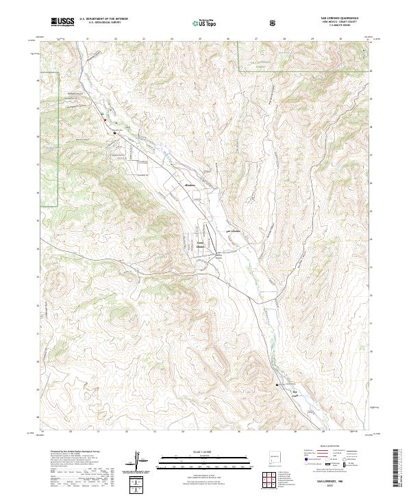
2023 Map of San Lorenzo
USGS Topo · Published 2023About this map
The Mimbres River valley serves as the primary corridor for settlement in this part of Grant County, where the high desert meets the southern edge of the Gila National Forest. The map documents a string of communities including Mimbres, San Lorenzo, Casas Adobes, and San Juan, each situated to take advantage of the riparian landscape. The infrastructure reveals a blend of traditional land use and modern residential development, visible in the network of local roads like Chavez Rd and Wigwam Ranch Rd.
Find a feature on this map
62 named features on this map. Tap any name to fly to it.
Don’t see what you’re looking for? This feature index may not catch every label — zoom into the map to look around manually.
Map Details
Editions of this 2023 San Lorenzo Map
This is the sole edition of this map. No revisions or reprints were ever made.
Other maps of this area

1909 · Silver City
USGS Topo · 1:125,000

1937 · Santa Rita
USGS Topo · 1:24,000

1947 · Allie Canyon
USGS Topo · 1:24,000

1948 · Santa Rita
USGS Topo · 1:24,000

1948 · Allie Canyon
USGS Topo · 1:24,000

1948 · Hurley East
USGS Topo · 1:24,000

1949 · Hurley East
USGS Topo · 1:24,000
1951 · Santa Rita
USGS Topo · 1:24,000

1954 · Silver City
USGS Topo · 1:250,000

1955 · Las Cruces
USGS Topo · 1:250,000