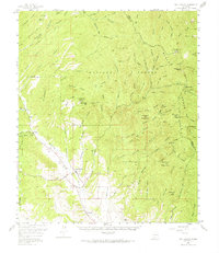
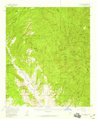
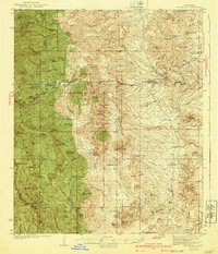
1956 Map of San Lorenzo
USGS Topo · Published 1968About this map
San Lorenzo and San Juan anchor the lower Mimbres Valley in this mid-century survey, a landscape defined by the drainage network of the Mimbres River and East Fork Mimbres River. The terrain transitions from the valley floor into the steep reaches of the Gila National Forest, where the Black Range forms a high eastern barrier. This area was a hub of resource extraction, evidenced by the concentration of high-altitude mining operations such as the Rose Mine, Columbia Mine, and the Grandview Mines near Sawyers Peak.
Find a feature on this map
78 named features on this map. Tap any name to fly to it.
Don’t see what you’re looking for? This feature index may not catch every label — zoom into the map to look around manually.
Map Details
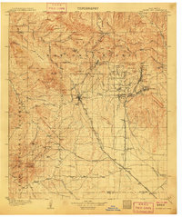
Editions of this 1956 San Lorenzo Map
2 editions found
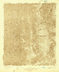
Other maps of this area
1909 · Silver City
USGS Topo · 1:125,000

1911 · Alum Mountain
USGS Topo · 1:125,000

1913 · Alum Mountain
USGS Topo · 1:125,000
1935 · Hillsboro
USGS Topo · 1:48,000

1937 · Santa Rita
USGS Topo · 1:24,000
1940 · Hillsboro
USGS Topo · 1:62,500
1947 · Allie Canyon
USGS Topo · 1:24,000

1948 · Santa Rita
USGS Topo · 1:24,000

1948 · Allie Canyon
USGS Topo · 1:24,000

1948 · Hurley East
USGS Topo · 1:24,000