
1922 Map of San Luis Creek
USGS Topo · Published 1922About this map
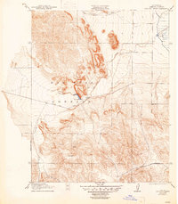
San Luis Ranch and (Howard Ranch) serve as the primary human focal points in this 1916 survey of the Central Valley foothills. The landscape is dominated by the San Luis Gonzaga land grant, where the seasonal waters of San Luis Creek and Romero Creek descend toward the plains. The presence of Basalt Hill indicates the distinct volcanic geology of the region, which contrasts with the alluvial flats found to the east. Transportation through this terrain is defined by the Pacheco Pass Road, a vital transit corridor connecting the coast and the interior valley before the modern highway system was fully realized. Numerous unnamed Spring points are scattered across the topography, highlighting the importance of water sources for cattle ranching in this arid environment during the early twentieth century.
Find a feature on this map
9 named features on this map. Tap any name to fly to it.
Don’t see what you’re looking for? This feature index may not catch every label — zoom into the map to look around manually.
Map Details
Editions of this 1922 San Luis Creek Map
2 editions found
Other maps of this area

1913 · Panoche
USGS Topo · 1:125,000

1919 · Ingomar
USGS Topo · 1:31,680

1920 · Pacheco Pass
USGS Topo · 1:62,500

1920 · Carrisalito Spring
USGS Topo · 1:31,680

1921 · Volta
USGS Topo · 1:31,680

1922 · Quien Sabe
USGS Topo · 1:62,500

1922 · Ortigalita
USGS Topo · 1:31,680

1922 · Howard Ranch
USGS Topo · 1:31,680

1940 · Pacheco Pass
USGS Topo · 1:62,500

1940 · Quien Sabe
USGS Topo · 1:62,500