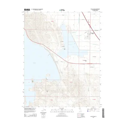
2015 Map of San Luis Dam
USGS Topo · Published 2015About this map
San Luis Dam stands as the central engineering feat on this landscape, anchoring the massive San Luis Reservoir and the adjacent O'Neil Forebay. The map details a critical junction of California's water infrastructure, where the Delta-Mendota Canal and the San Luis Wasteway manage the flow through the San Joaquin Valley. To the northeast, the residential layout of Santa Nella Village appears near the intersection of several local routes, including Henry Miller Rd and Santa Nella Rd.
Find a feature on this map
37 named features on this map. Tap any name to fly to it.
Don’t see what you’re looking for? This feature index may not catch every label — zoom into the map to look around manually.
Map Details
Editions of this 2015 San Luis Dam Map
This is the sole edition of this map. No revisions or reprints were ever made.
Other maps of this area

1913 · Panoche
USGS Topo · 1:125,000

1919 · Ingomar
USGS Topo · 1:31,680

1920 · Pacheco Pass
USGS Topo · 1:62,500

1920 · Carrisalito Spring
USGS Topo · 1:31,680

1921 · Volta
USGS Topo · 1:31,680

1922 · Quien Sabe
USGS Topo · 1:62,500

1922 · San Luis Creek
USGS Topo · 1:31,680

1922 · Ortigalita
USGS Topo · 1:31,680

1922 · Howard Ranch
USGS Topo · 1:31,680

1940 · Pacheco Pass
USGS Topo · 1:62,500