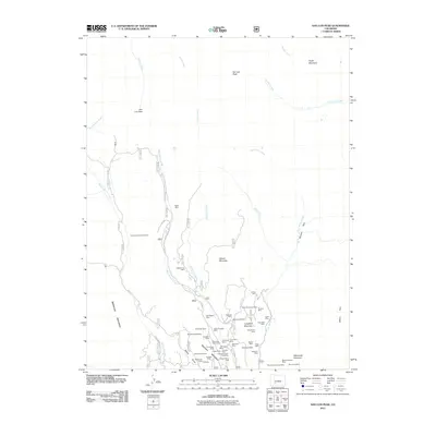
2011 Map of San Luis Peak
USGS Topo · Published 2011About this map
Bachelor Mountain and its surrounding peaks dominate this survey, revealing an intensive landscape of silver and base metal extraction in the San Juan Mountains. The high-altitude terrain is marked by a dense concentration of historical claims, particularly along the drainage of West Willow Creek. Notable operations like the Amethyst Mine, Last Chance Mine, and the Sloan Tunnel Mine cluster on the slopes, indicating a complex network of underground workings and haulage roads such as W Willow Ck Rd. The topography rises sharply toward the north to reach San Luis Peak, where the industrial character of the southern slopes gives way to the open drainages of Cochetopa Creek and Stewart Creek. This record documents the enduring physical footprint of the mining era, preserving the locations of deep-shaft operations and mountain tunnels from Windy Gulch to Nelson Mountain.
Find a feature on this map
62 named features on this map. Tap any name to fly to it.
Don’t see what you’re looking for? This feature index may not catch every label — zoom into the map to look around manually.
Map Details
Editions of this 2011 San Luis Peak Map
This is the sole edition of this map. No revisions or reprints were ever made.
Other maps of this area

1905 · San Cristobal
USGS Topo · 1:125,000

1907 · San Cristobal
USGS Topo · 1:125,000

1908 · Uncompahgre
USGS Topo · 1:125,000

1911 · Uncompahgre
USGS Topo · 1:125,000

1914 · Creede
USGS Topo · 1:125,000

1916 · Creede
USGS Topo · 1:125,000

1945 · Durango
USGS Topo · 1:250,000

1953 · Durango
USGS Topo · 1:250,000

1954 · Durango
USGS Topo · 1:250,000

1956 · Montrose
USGS Topo · 1:250,000