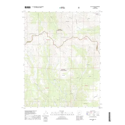
2019 Map of San Luis Peak
USGS Topo · Published 2019About this map
San Luis Peak dominates this high-altitude landscape within the Gunnison National Forest and Rio Grande National Forest. The map documents the intricate drainage systems of the San Juan Mountains, including Stewart Creek, Whited Cr, and W Willow Cr. The Continental Divide National Scenic Trail winds through the northern portion of the quadrangle, crossing San Luis Pass as it follows the spine of the continental divide. In the southeast, Phoenix Park sits nestled between Mammoth Mtn and Campbell Mtn. This 2019 survey provides contemporary details on the rugged forest boundaries and the network of trails and watercourses that define this alpine region, including the La Garita SD land division and the transition into Saguache Co.
Find a feature on this map
33 named features on this map. Tap any name to fly to it.
Don’t see what you’re looking for? This feature index may not catch every label — zoom into the map to look around manually.
Map Details
Editions of this 2019 San Luis Peak Map
This is the sole edition of this map. No revisions or reprints were ever made.
Other maps of this area

1905 · San Cristobal
USGS Topo · 1:125,000

1907 · San Cristobal
USGS Topo · 1:125,000

1908 · Uncompahgre
USGS Topo · 1:125,000

1911 · Uncompahgre
USGS Topo · 1:125,000

1914 · Creede
USGS Topo · 1:125,000

1916 · Creede
USGS Topo · 1:125,000

1945 · Durango
USGS Topo · 1:250,000

1953 · Durango
USGS Topo · 1:250,000

1954 · Durango
USGS Topo · 1:250,000

1956 · Montrose
USGS Topo · 1:250,000