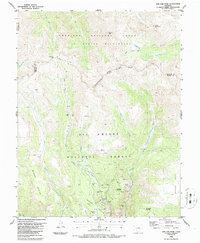
1986 Map of San Luis Peak
USGS Topo · Published 1986About this map
Mining operations dominate the lower slopes of Bachelor Mountain and Nelson Mountain in this mid-1980s topographical study of the Colorado high country. The map documents a dense network of historic lode claims and workings concentrated along the drainages of West Willow Creek and Nelson Creek, including the Amethyst Mine, Commodore Mine, and the Holy Moses Mine. These sites represent the enduring legacy of the Creede mining district's silver and lead production. High above these industrial relics, the Continental Divide National Forest Boundary separates the Rio Grande National Forest from the Gunnison National Forest. The landscape transitions from the clustered shafts and tunnels of the Equity Mine to the high alpine reaches of San Luis Peak and the La Garita Wilderness, where the Skyline Trail (Pack) provides passage through the high-altitude terrain.
Find a feature on this map
42 named features on this map. Tap any name to fly to it.
Don’t see what you’re looking for? This feature index may not catch every label — zoom into the map to look around manually.
Map Details
Editions of this 1986 San Luis Peak Map
This is the sole edition of this map. No revisions or reprints were ever made.
Other maps of this area

1905 · San Cristobal
USGS Topo · 1:125,000

1907 · San Cristobal
USGS Topo · 1:125,000

1908 · Uncompahgre
USGS Topo · 1:125,000

1911 · Uncompahgre
USGS Topo · 1:125,000

1914 · Creede
USGS Topo · 1:125,000

1916 · Creede
USGS Topo · 1:125,000

1945 · Durango
USGS Topo · 1:250,000

1953 · Durango
USGS Topo · 1:250,000

1954 · Durango
USGS Topo · 1:250,000

1956 · Montrose
USGS Topo · 1:250,000