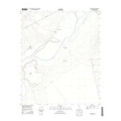
2013 Map of San Marcial
USGS Topo · Published 2013About this map
The Rio Grande flows through this Socorro County landscape, flanked by the distinct elevations of Mesa Peak and Mesa del Contadero to the west and the arid expanse of the Jornada del Muerto to the east. This 2013 survey illustrates the sparse settlement pattern of the region, anchored by locations such as San Marcial and Val Verde. Near the center of the sheet, Tiffany and Tiffany Canyon sit alongside Torreon Arroyo, while the San Antonio Ditch traces a path through the valley floor.
Find a feature on this map
16 named features on this map. Tap any name to fly to it.
Don’t see what you’re looking for? This feature index may not catch every label — zoom into the map to look around manually.
Map Details
Editions of this 2013 San Marcial Map
This is the sole edition of this map. No revisions or reprints were ever made.
Other maps of this area

1948 · San Antonio
USGS Topo · 1:62,500

1948 · Val Verde
USGS Topo · 1:62,500

1954 · Tularosa
USGS Topo · 1:250,000

1958 · Tularosa
USGS Topo · 1:250,000

1961 · Paraje Well
USGS Topo · 1:24,000

1961 · Fort Craig
USGS Topo · 1:24,000
1965 · Cienega Ranch
USGS Topo · 1:24,000

1979 · San Mateo Mountains
USGS Topo · 1:100,000
1981 · Indian Well Wilderness
USGS Topo · 1:24,000
1981 · Harriet Ranch
USGS Topo · 1:24,000