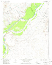
1982 Map of San Marcial
USGS Topo · Published 1982About this map
Rio Grande hydrology and the remnants of early 20th-century rail life define this desert landscape in Socorro County. The map details the engineered path of the Conveyance Channel alongside the traditional riverbed, illustrating the complex water management required in this arid corridor. Near the river, the site of San Marcial and Val Verde (Site) represent a significant historical geography; San Marcial was once a bustling railroad hub that faced devastating floods before its eventual decline.
Find a feature on this map
28 named features on this map. Tap any name to fly to it.
Don’t see what you’re looking for? This feature index may not catch every label — zoom into the map to look around manually.
Map Details
Editions of this 1982 San Marcial Map
This is the sole edition of this map. No revisions or reprints were ever made.
Other maps of this area

1948 · San Antonio
USGS Topo · 1:62,500

1948 · Val Verde
USGS Topo · 1:62,500

1954 · Tularosa
USGS Topo · 1:250,000

1958 · Tularosa
USGS Topo · 1:250,000

1961 · Paraje Well
USGS Topo · 1:24,000

1961 · Fort Craig
USGS Topo · 1:24,000
1965 · Cienega Ranch
USGS Topo · 1:24,000

1979 · San Mateo Mountains
USGS Topo · 1:100,000
1981 · Indian Well Wilderness
USGS Topo · 1:24,000

1981 · Harriet Ranch
USGS Topo · 1:24,000