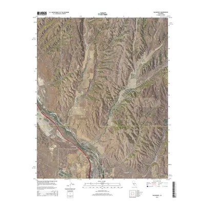
2015 Map of San Miguel
USGS Topo · Published 2015About this map
The Salinas River valley serves as the central artery for this region, where the town of San Miguel sits at the southern bend. The landscape is defined by a dense network of drainages including Big Sandy Cr and San Jacinto Cr, which have carved numerous named landforms such as Mahoney Canyon and Vineyard Canyon. These natural corridors have historically influenced transportation patterns, as seen in the route of Vineyard Canyon Rd and Indian Valley Rd. In the northern portion of the map, the settlement of Nacimiento lies near the riverbanks, while McKay is positioned further south along the rail and road corridor. The topography transitions from the river bottom to higher elevations marked by Tunnel Canyon and Hare Canyon, showing how the early 21st-century infrastructure of San Luis Obispo County and Monterey County has adapted to the winding valley floor.
Find a feature on this map
45 named features on this map. Tap any name to fly to it.
Don’t see what you’re looking for? This feature index may not catch every label — zoom into the map to look around manually.
Map Details
Editions of this 2015 San Miguel Map
This is the sole edition of this map. No revisions or reprints were ever made.
Other maps of this area

1919 · San Miguel
USGS Topo · 1:62,500

1919 · Paso Robles
USGS Topo · 1:62,500

1919 · Bradley
USGS Topo · 1:62,500

1919 · Adelaida
USGS Topo · 1:62,500

1932 · Adelaida
USGS Topo · 1:62,500

1941 · Bradley
USGS Topo · 1:62,500

1942 · Adelaida
USGS Topo · 1:62,500

1943 · Paso Robles
USGS Topo · 1:62,500

1947 · San Luis Obispo
USGS Topo · 1:250,000

1947 · San Miguel
USGS Topo · 1:62,500