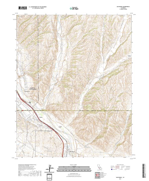
2021 Map of San Miguel
USGS Topo · Published 2021About this map
San Miguel anchors the southern portion of this landscape, situated along the broad valley formed by the Salinas River. The terrain is defined by a series of parallel canyons and ridges, including the prominent Vineyard Canyon and Mahoney Canyon, which cut through the hills east of the river. The boundary between Monterey and San Luis Obispo counties bisects the map, illustrating the administrative divide that separates the settlements of Nacimiento and McKay from the historic core of San Miguel. The road network, featuring routes like Mission St and Indian Valley Rd, follows the natural contours of the land, connecting the river valley to the agricultural hinterlands. To the north, the confluence of Big Sandy Cr and the Salinas River marks a shift in the drainage patterns, while the deep recesses of Portuguese Canyon and Deer Canyon provide insight into the drainage systems that feed the regional watershed.
Find a feature on this map
50 named features on this map. Tap any name to fly to it.
Don’t see what you’re looking for? This feature index may not catch every label — zoom into the map to look around manually.
Map Details
Editions of this 2021 San Miguel Map
This is the sole edition of this map. No revisions or reprints were ever made.
Other maps of this area

1919 · San Miguel
USGS Topo · 1:62,500

1919 · Paso Robles
USGS Topo · 1:62,500

1919 · Bradley
USGS Topo · 1:62,500

1919 · Adelaida
USGS Topo · 1:62,500

1932 · Adelaida
USGS Topo · 1:62,500

1941 · Bradley
USGS Topo · 1:62,500

1942 · Adelaida
USGS Topo · 1:62,500

1943 · Paso Robles
USGS Topo · 1:62,500

1947 · San Luis Obispo
USGS Topo · 1:250,000

1947 · San Miguel
USGS Topo · 1:62,500