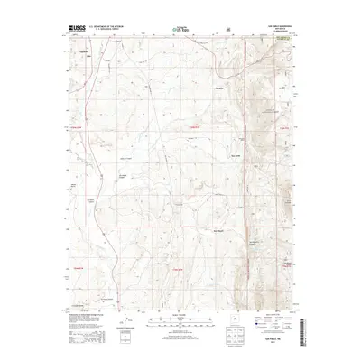
2013 Map of San Pablo
USGS Topo · Published 2013About this map
Rio Puerco flows through this high-altitude New Mexico landscape, marking a transition between the open valley near Cuba and the rising timber of the Santa Fe National Forest. The 2013 landscape is characterized by a network of rural settlements and ranches, including San Pablo, San Miguel, and the Blue Bird Ranch. To the north, the historic community of Señorito and the small enclave of Lagunitas are linked by a complex road system including State Hwy 126 and various forest routes like Forest Road 20. The terrain is deeply incised by drainages such as Señorito Canyon and Arroyo Hondo, providing a clear record of the area's hydrology and land-use patterns. Genealogists and local historians can trace the connection between these small villages and landmarks like Campo el Deseo or the water sources at San Miguel Spring.
Find a feature on this map
41 named features on this map. Tap any name to fly to it.
Don’t see what you’re looking for? This feature index may not catch every label — zoom into the map to look around manually.
Map Details
Editions of this 2013 San Pablo Map
This is the sole edition of this map. No revisions or reprints were ever made.
Other maps of this area

1883 · Mt. Taylor
USGS Topo · 1:250,000

1886 · Mt. Taylor
USGS Topo · 1:250,000

1889 · Largo
USGS Topo · 1:250,000

1890 · Jemes
USGS Topo · 1:125,000

1892 · Jemes
USGS Topo · 1:125,000

1892 · Mt. Taylor
USGS Topo · 1:250,000

1895 · Largo
USGS Topo · 1:250,000

1899 · Mt. Taylor
USGS Topo · 1:250,000

1909 · Gallina
USGS Topo · 1:125,000

1939 · La Ventana
USGS Topo · 1:62,500