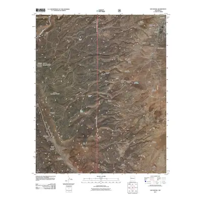
2011 Map of San Rafael
USGS Topo · Published 2011About this map
San Rafael anchors the northeastern corner of this landscape, situated near the spring waters of Ojo del Gallo and the San Rafael Post Office. The surrounding terrain transitions from the high elevations of San Rafael Mesa and Gallo Peak into a series of deep canyons and draws, including Sawmill Canyon and Agua Fria Trail Canyon. Genealogists and local historians can locate the Porter Cemetery east of the main settlement near Fort Wingate Rd.
Find a feature on this map
46 named features on this map. Tap any name to fly to it.
Don’t see what you’re looking for? This feature index may not catch every label — zoom into the map to look around manually.
Map Details
Editions of this 2011 San Rafael Map
This is the sole edition of this map. No revisions or reprints were ever made.
Other maps of this area

1883 · Mt. Taylor
USGS Topo · 1:250,000

1886 · Wingate
USGS Topo · 1:250,000

1886 · Mt. Taylor
USGS Topo · 1:250,000

1892 · Wingate
USGS Topo · 1:250,000

1892 · Mt. Taylor
USGS Topo · 1:250,000

1899 · Mt. Taylor
USGS Topo · 1:250,000

1917 · Broom Mountain
USGS Topo · 1:125,000

1951 · Mt Sedgwick
USGS Topo · 1:24,000

1952 · Paxton Springs
USGS Topo · 1:24,000

1954 · Saint Johns
USGS Topo · 1:250,000