
1951 Map of Mt Sedgwick
USGS Topo · Published 1953About this map
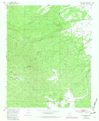
Cibola National Forest encompasses the high-altitude landscape of Valencia County, New Mexico, dominated by the peak of Mt Sedgwick. This 1951 field check captures a rugged interior environment defined by massive plateau features like Salitre Mesa and a complex drainage system of deep canyons. These corridors, including Pole Canyon and Limekiln Canyon, carve through the forest, revealing the area's geological character. Significant water sources like Ojo Redondo and its associated Ojo Redondo Canyon indicate the scarce but vital riparian locations in this arid upland. The presence of isolated windmills and unimproved trails suggests a landscape primarily used for seasonal grazing and forest management rather than permanent settlement. The eastern boundary of the forest is clearly delineated, showing where the wilderness of Cerro Colorado meets the surrounding territory.
Find a feature on this map
12 named features on this map. Tap any name to fly to it.
Don’t see what you’re looking for? This feature index may not catch every label — zoom into the map to look around manually.
Map Details
Editions of this 1951 Mt Sedgwick Map
2 editions found
Other maps of this area

1883 · Mt. Taylor
USGS Topo · 1:250,000

1886 · Wingate
USGS Topo · 1:250,000

1886 · Mt. Taylor
USGS Topo · 1:250,000

1892 · Wingate
USGS Topo · 1:250,000

1892 · Mt. Taylor
USGS Topo · 1:250,000

1899 · Mt. Taylor
USGS Topo · 1:250,000

1952 · Valle Largo
USGS Topo · 1:24,000

1952 · Post Office Flat
USGS Topo · 1:24,000

1952 · Paxton Springs
USGS Topo · 1:24,000

1954 · Gallup
USGS Topo · 1:250,000