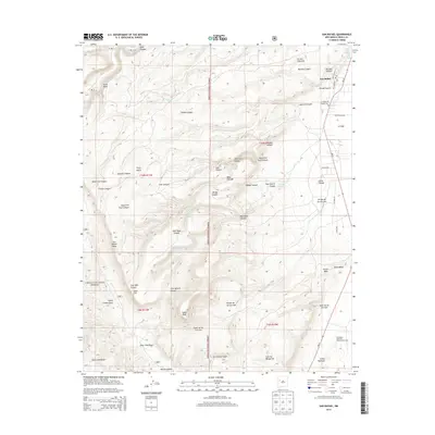
2013 Map of San Rafael
USGS Topo · Published 2013About this map
The high-desert landscape of western New Mexico is deeply etched by water and wind, centered on the historic settlement of San Rafael. This region, documented during the early 21st century, showcases a network of deep-cut drainage features such as Hondo Canyon and Sawmill Canyon that descend toward the town and the headwaters of Ojo del Gallo. The mapping includes significant local landmarks like the Porter Cem and the Post Office, which serve as focal points for the community nestled at the edge of the Cibola National Forest. To the south and west, the terrain rises into prominent formations like San Rafael Mesa and Gallo Peak. The presence of labels like Fools Gold Draw and Bonita Canyon hints at the area's prospecting and ranching heritage, while the eastern boundary borders the stark volcanic landscape of the El Malpais National Conservation Area.
Find a feature on this map
48 named features on this map. Tap any name to fly to it.
Don’t see what you’re looking for? This feature index may not catch every label — zoom into the map to look around manually.
Map Details
Editions of this 2013 San Rafael Map
This is the sole edition of this map. No revisions or reprints were ever made.
Other maps of this area

1883 · Mt. Taylor
USGS Topo · 1:250,000

1886 · Wingate
USGS Topo · 1:250,000

1886 · Mt. Taylor
USGS Topo · 1:250,000

1892 · Wingate
USGS Topo · 1:250,000

1892 · Mt. Taylor
USGS Topo · 1:250,000

1899 · Mt. Taylor
USGS Topo · 1:250,000

1917 · Broom Mountain
USGS Topo · 1:125,000

1951 · Mt Sedgwick
USGS Topo · 1:24,000

1952 · Paxton Springs
USGS Topo · 1:24,000

1954 · Saint Johns
USGS Topo · 1:250,000