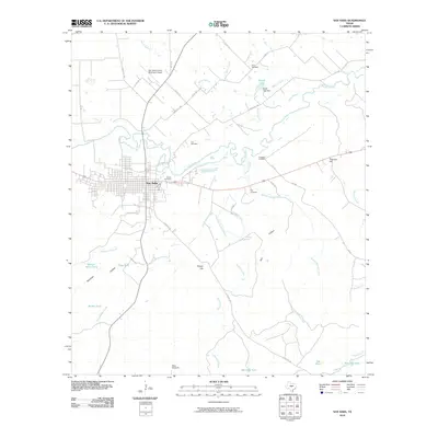
2010 Map of San Saba
USGS Topo · Published 2010About this map
San Saba serves as the central hub of this Central Texas landscape, situated at the confluence of several key waterways including the San Saba River and Mill Creek. The town's layout is meticulously detailed, showing its proximity to local infrastructure like the San Saba County Municipal Airport to the north. The surrounding countryside is defined by its water resources, from the Ratliff Lake reservoir to numerous named stock tanks such as Watson-Miller Tank and Big Sally Tank, reflecting the area's agricultural foundations.
Find a feature on this map
50 named features on this map. Tap any name to fly to it.
Don’t see what you’re looking for? This feature index may not catch every label — zoom into the map to look around manually.
Map Details
Editions of this 2010 San Saba Map
This is the sole edition of this map. No revisions or reprints were ever made.
Other maps of this area

1885 · San Saba
USGS Topo · 1:125,000

1894 · San Saba
USGS Topo · 1:125,000

1925 · San Saba 4-a
USGS Topo · 1:48,000

1925 · San Saba 1-c
USGS Topo · 1:48,000

1925 · San Saba 1-d
USGS Topo · 1:48,000

1928 · Goldthwaite
USGS Topo · 1:62,500

1930 · Richland Springs
USGS Topo · 1:62,500

1931 · Bend
USGS Topo · 1:62,500

1948 · Richland Springs
USGS Topo · 1:62,500

1948 · Goldthwaite
USGS Topo · 1:62,500