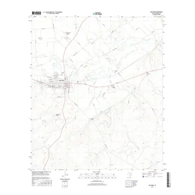
2016 Map of San Saba
USGS Topo · Published 2016About this map
San Saba serves as the focal point of this Central Texas landscape, situated along the southern banks of the San Saba River. The town's grid is well-established, anchored by the San Saba City Cem and the San Saba County Municipal Airport to the north. Water dominates the northern and eastern portions of the map, where Jerrys Br, Rabbit Cr, and Simpson Cr weave through the terrain, punctuated by features like Ratliff Lake and Barnett Springs. To the south, the topography rises toward Chapel Hill and Bannister Hollow, showing a landscape transitioning from river bottomland to upland drainage basins for Dry Simpson Cr. Genealogy researchers will find several family-named burial grounds scattered outside the town center, including Linn Cem, Brown Cem, and Terry Cem. The map illustrates the 2016 road network, dominated by Us Highway 190 and a system of farm-to-market and ranch roads connecting the outlying Fort Hollow area to the county seat.
Find a feature on this map
92 named features on this map. Tap any name to fly to it.
Don’t see what you’re looking for? This feature index may not catch every label — zoom into the map to look around manually.
Map Details
Editions of this 2016 San Saba Map
This is the sole edition of this map. No revisions or reprints were ever made.
Other maps of this area

1885 · San Saba
USGS Topo · 1:125,000

1894 · San Saba
USGS Topo · 1:125,000

1925 · San Saba 4-a
USGS Topo · 1:48,000

1925 · San Saba 1-c
USGS Topo · 1:48,000

1925 · San Saba 1-d
USGS Topo · 1:48,000

1928 · Goldthwaite
USGS Topo · 1:62,500

1930 · Richland Springs
USGS Topo · 1:62,500

1931 · Bend
USGS Topo · 1:62,500

1948 · Richland Springs
USGS Topo · 1:62,500

1948 · Goldthwaite
USGS Topo · 1:62,500