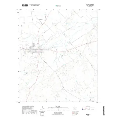
2019 Map of San Saba
USGS Topo · Published 2019About this map
San Saba serves as the central hub of this Texas Hill Country landscape, situated where the San Saba River meanders through a terrain of limestone draws and springs. The town's grid is anchored by the San Saba City Cem, while the surrounding ranchland is dotted with smaller family or community burial grounds including Brown Cem, Farr Cem, and Linn Cem. This distribution of cemeteries across the countryside reflects the early settlement patterns of San Saba County, where individual homesteads and small family groups established themselves along permanent water sources like Simpson Cr and Rabbit Cr.
Find a feature on this map
91 named features on this map. Tap any name to fly to it.
Don’t see what you’re looking for? This feature index may not catch every label — zoom into the map to look around manually.
Map Details
Editions of this 2019 San Saba Map
This is the sole edition of this map. No revisions or reprints were ever made.
Other maps of this area

1885 · San Saba
USGS Topo · 1:125,000

1894 · San Saba
USGS Topo · 1:125,000

1925 · San Saba 4-a
USGS Topo · 1:48,000

1925 · San Saba 1-c
USGS Topo · 1:48,000

1925 · San Saba 1-d
USGS Topo · 1:48,000

1928 · Goldthwaite
USGS Topo · 1:62,500

1930 · Richland Springs
USGS Topo · 1:62,500

1931 · Bend
USGS Topo · 1:62,500

1948 · Richland Springs
USGS Topo · 1:62,500

1948 · Goldthwaite
USGS Topo · 1:62,500