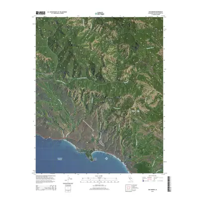
2015 Map of San Simeon
USGS Topo · Published 2015About this map
San Simeon Bay serves as the focal point of this coastal landscape, where the Pacific Ocean meets the steep, rising ridges of the Santa Lucia Range. The map illustrates the specialized infrastructure surrounding the historic Hearst estate, most notably Hearst Castle Rd and the North Entrance Rock near San Simeon Point. This area is characterized by a complex network of seasonal drainages and coastal canyons, including Arroyo del Puerto and Arroyo De La Laguna, which carve through the high terrain of Burnett Peak and Garrity Peak. Inland, the terrain becomes increasingly steep and marked by distinct landmarks such as Rocky Butte and the tiered Three Troughs Falls, illustrating the dramatic vertical elevation changes that define this portion of the Central Coast.
Find a feature on this map
31 named features on this map. Tap any name to fly to it.
Don’t see what you’re looking for? This feature index may not catch every label — zoom into the map to look around manually.
Map Details
Editions of this 2015 San Simeon Map
This is the sole edition of this map. No revisions or reprints were ever made.
Other maps of this area

1919 · Bryson
USGS Topo · 1:62,500

1919 · Piedras Blancas
USGS Topo · 1:62,500

1919 · San Simeon
USGS Topo · 1:62,500

1921 · Cape San Martin
USGS Topo · 1:62,500

1927 · Piedras Blancas
USGS Topo · 1:62,500

1937 · San Simeon
USGS Topo · 1:62,500

1941 · Cape San Martin
USGS Topo · 1:62,500

1941 · Bryson
USGS Topo · 1:62,500

1942 · Bryson
USGS Topo · 1:62,500

1942 · Cape San Martin
USGS Topo · 1:62,500