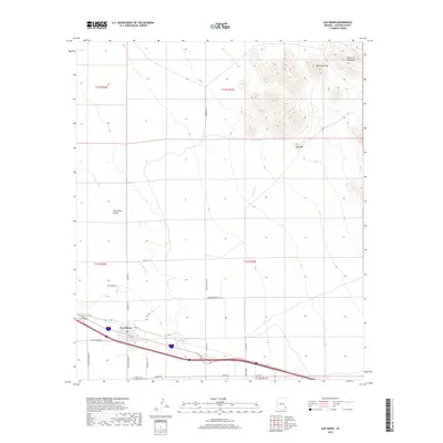
2018 Map of San Simon
USGS Topo · Published 2018About this map
San Simon serves as the focal point of this arid landscape, situated within the broad San Simon Valley where the seasonal San Simon River cuts through the desert floor. The town's grid is clearly defined, with residential and transport-related streets such as 1st St and 7th St bounded by Sellers Ranch Rd. To the northeast, the terrain rises sharply into the Peloncillo Mountains, dominated by high points like McKenzie Peak and Gold Hill. The map illustrates a ranching and transit-oriented corridor, where deep-well water sources like Hat Top Tank and numerous named roads—including Kennedy Rd and Wood Canyon Rd—connect remote desert reaches to the central settlement and highway infrastructure. This survey documents the intersection of modern logistics and the enduring geography of the Arizona high desert.
Find a feature on this map
34 named features on this map. Tap any name to fly to it.
Don’t see what you’re looking for? This feature index may not catch every label — zoom into the map to look around manually.
Map Details
Editions of this 2018 San Simon Map
This is the sole edition of this map. No revisions or reprints were ever made.
Other maps of this area

1917 · San Simon
USGS Topo · 1:125,000

1926 · Cochise Head
USGS Topo · 1:62,500

1926 · Orange Butte
USGS Topo · 1:62,500

1928 · Chenoweth
USGS Topo · 1:62,500

1928 · Bowie
USGS Topo · 1:62,500

1949 · Bowie
USGS Topo · 1:62,500

1950 · San Simon
USGS Topo · 1:62,500

1950 · Bowie
USGS Topo · 1:62,500

1950 · Cochise Head
USGS Topo · 1:62,500

1950 · Vanar
USGS Topo · 1:62,500