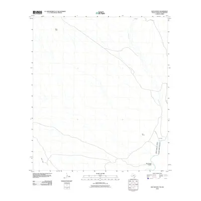
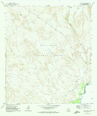
2010 Map of San Vicente
USGS Topo · Published 2010About this map
Rio Grande waters define the international border in this remote desert reach, where the United States of America and Mexico meet. The landscape is dominated by ephemeral drainage systems such as Tornillo Creek and Glenn Draw that carve through the arid terrain. Human presence is centered on the small settlement of San Vicente and the historical transit point at San Vicente Crossing. The presence of the Old Ore Rd in the northeast corner of the map suggests the region's historical connection to early mining and transportation routes. Topographical landmarks like Black Knob and the rise of La Clocha provide distinct navigational points in an otherwise sparsely populated environment. This 2010 survey captures a specific moment of borderland history, showing the intersection of natural geography and the deliberate lines of international boundaries.
Find a feature on this map
11 named features on this map. Tap any name to fly to it.
Don’t see what you’re looking for? This feature index may not catch every label — zoom into the map to look around manually.
Map Details
Editions of this 2010 San Vicente Map
This is the sole edition of this map. No revisions or reprints were ever made.
Other maps of this area

1903 · Chisos Mountains
USGS Topo · 1:125,000

1905 · Chisos Mountains
USGS Topo · 1:125,000

1930 · Stillwell Creek
USGS Topo · 1:62,500

1959 · Emory Peak
USGS Topo · 1:250,000

1965 · Emory Peak
USGS Topo · 1:250,000
1970 · Solis
USGS Topo · 1:24,000

1971 · Glenn Spring
USGS Topo · 1:24,000
1971 · Ernst Valley
USGS Topo · 1:24,000
1971 · Boquillas
USGS Topo · 1:24,000
1971 · San Vicente
USGS Topo · 1:24,000