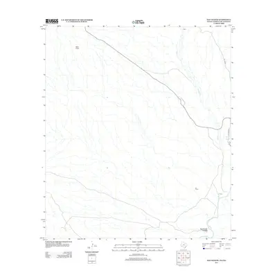
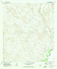
2012 Map of San Vicente
USGS Topo · Published 2012About this map
San Vicente Crossing serves as a focal point along the Rio Grande in this desert borderland. The landscape is defined by the braided drainage of Tornillo Cr and the thermal presence of Boquillas Hot Springs at the river's edge. This 2012 survey illustrates the sparse, high-desert settlement pattern characterized by small locales like San Vicente and La Clocha. Navigation through this arid terrain relies on historic corridors such as Old Ore Rd and Hot Springs Rd, which follow the contours of the land toward the river. To the north, La Noria sits in an expanse marked by distinctive topographic features like Black Knob, reflecting the isolated ranching and mining heritage of Brewster County.
Find a feature on this map
10 named features on this map. Tap any name to fly to it.
Don’t see what you’re looking for? This feature index may not catch every label — zoom into the map to look around manually.
Map Details
Editions of this 2012 San Vicente Map
This is the sole edition of this map. No revisions or reprints were ever made.
Other maps of this area

1903 · Chisos Mountains
USGS Topo · 1:125,000

1905 · Chisos Mountains
USGS Topo · 1:125,000

1930 · Stillwell Creek
USGS Topo · 1:62,500

1959 · Emory Peak
USGS Topo · 1:250,000

1965 · Emory Peak
USGS Topo · 1:250,000
1970 · Solis
USGS Topo · 1:24,000

1971 · Glenn Spring
USGS Topo · 1:24,000
1971 · Ernst Valley
USGS Topo · 1:24,000
1971 · Boquillas
USGS Topo · 1:24,000
1971 · San Vicente
USGS Topo · 1:24,000