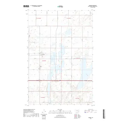
2018 Map of Sanborn
USGS Topo · Published 2018About this map
Sanborn serves as the primary hub of this Barnes County landscape, characterized by its grid of rural roads and a sequence of significant water bodies. The community is anchored by local institutions including the Po, while its history is preserved in several surrounding burial grounds like Saint Peter Cem, Sacred Heart Cem, and Fairview Cem. A distinct north-south chain of lakes—Sanborn Lake, Round Lake, and Sweetwater Lake—bisects the prairie, influencing the local topography and road placement. The intersection of Co HWY 11 and various section-line roads, such as 34th ST Se and Airport RD, shows a persistent agricultural pattern in the late 2010s. Farther east, the expanse of Hobart Lake dominates the terrain, while the outlying Nebo Cem provides another point of interest for those tracing family history in this portion of North Dakota.
Find a feature on this map
28 named features on this map. Tap any name to fly to it.
Don’t see what you’re looking for? This feature index may not catch every label — zoom into the map to look around manually.
Map Details
Editions of this 2018 Sanborn Map
This is the sole edition of this map. No revisions or reprints were ever made.
Other maps of this area

1897 · Eckelson
USGS Topo · 1:125,000

1952 · New Rockford
USGS Topo · 1:250,000

1953 · Jamestown
USGS Topo · 1:250,000

1956 · New Rockford
USGS Topo · 1:250,000

1956 · Jamestown
USGS Topo · 1:250,000

1961 · Leal
USGS Topo · 1:24,000

1961 · Baldhill Dam
USGS Topo · 1:24,000

1961 · Valley City West
USGS Topo · 1:24,000

1961 · Rogers
USGS Topo · 1:24,000

1970 · Eckelson
USGS Topo · 1:24,000