2024 Map of Sanborn
USGS Topo · Published 2024About this map
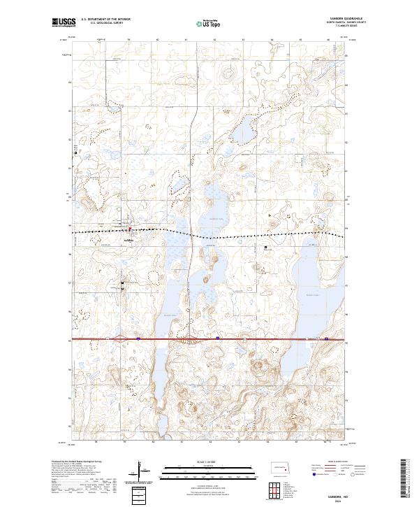
Sanborn serves as the primary settlement in this section of Barnes County, situated at the junction of Bauder St and Washington St. The surrounding prairie is defined by an extensive network of conservation lands, including the fragmented Barnes County Waterfowl Production Area and the Hobart Lake National Wildlife Refuge to the southeast. These protected zones surround several large prairie potholes, most notably Sanborn Lake, Round Lake, and Hobart Lake. For those tracing local history, several distinct burial grounds are located on the outskirts of the town and in the surrounding townships, including Fairview Cem, Sacred Heart Cem, Saint Peter Cem, and the more isolated Nebo Cem to the east. The landscape is organized by a precise grid of rural routes such as Airport Rd and 34th St SE, reflecting the deep agricultural roots of this North Dakota region.
Find a feature on this map
29 named features on this map. Tap any name to fly to it.
Don’t see what you’re looking for? This feature index may not catch every label — zoom into the map to look around manually.
Map Details
Editions of this 2024 Sanborn Map
This is the sole edition of this map. No revisions or reprints were ever made.