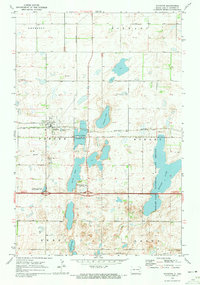
1970 Map of Sanborn
USGS Topo · Published 1973About this map
Sanborn serves as the central hub of this prairie landscape, where the Burlington Northern railroad corridor and local agriculture define the local economy. The terrain is notably characterized by a complex of water bodies including Sanborn Lake, Round Lake, and the expansive Hobart Lake to the east. These wetlands are preserved within the National Wildlife Management Area and the National Wildlife Refuge, illustrating a deliberate balance between land cultivation and habitat conservation. Genealogists will find several burial sites scattered across the townships, from St Peter Cem in the north to Sacred Heart Cem, Fairview Cem, and Nebo Cem further south. The map's detailed plotting of fence lines and field boundaries provides an intimate look at the 1970s land division in Potter and Stewart townships.
Find a feature on this map
21 named features on this map. Tap any name to fly to it.
Don’t see what you’re looking for? This feature index may not catch every label — zoom into the map to look around manually.
Map Details
Editions of this 1970 Sanborn Map
This is the sole edition of this map. No revisions or reprints were ever made.
Other maps of this area

1897 · Eckelson
USGS Topo · 1:125,000

1952 · New Rockford
USGS Topo · 1:250,000

1953 · Jamestown
USGS Topo · 1:250,000

1956 · New Rockford
USGS Topo · 1:250,000

1956 · Jamestown
USGS Topo · 1:250,000

1961 · Leal
USGS Topo · 1:24,000

1961 · Baldhill Dam
USGS Topo · 1:24,000

1961 · Valley City West
USGS Topo · 1:24,000

1961 · Rogers
USGS Topo · 1:24,000

1970 · Eckelson
USGS Topo · 1:24,000