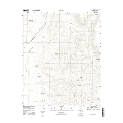
2013 Map of Sand Canyon
USGS Topo · Published 2013About this map
El Malpais National Monument dominates the western edge of this Cibola County landscape, where the ancient volcanic flows of The Malpais meet the sharp rise of Cebollita Mesa. The area is characterized by a network of deep drainages and canyons, including Cebolla Canyon and Armijo Canyon, which have historically provided essential water sources in this arid environment. The map reveals a legacy of ranching and land management through a series of named water features and landmarks such as Armijo Spring and several numbered wells, including the Henson Number 1 Windmill and Woods Number 1 Windmill. These isolated improvements, often located at the intersection of rugged tracks like Lava Falls Rd and Homestead Canyon Rd, trace the efforts of early 21st-century inhabitants to utilize this high-desert terrain for livestock and transit.
Find a feature on this map
33 named features on this map. Tap any name to fly to it.
Don’t see what you’re looking for? This feature index may not catch every label — zoom into the map to look around manually.
Map Details
Editions of this 2013 Sand Canyon Map
This is the sole edition of this map. No revisions or reprints were ever made.
Other maps of this area

1917 · Broom Mountain
USGS Topo · 1:125,000

1954 · Saint Johns
USGS Topo · 1:250,000

1954 · Socorro
USGS Topo · 1:250,000

1957 · Saint Johns
USGS Topo · 1:250,000

1958 · Socorro
USGS Topo · 1:250,000

1958 · Saint Johns
USGS Topo · 1:250,000
1961 · North Pasture
USGS Topo · 1:24,000
1961 · Laguna Honda
USGS Topo · 1:24,000

1962 · Socorro
USGS Topo · 1:250,000

1962 · Saint Johns
USGS Topo · 1:250,000