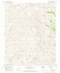
1965 Map of Sand Canyon
USGS Topo · Published 1966About this map
The Mount Poso Oil Field dominates the southwestern corner of this mid-1960s Kern County landscape, marking the intersection of petroleum extraction and rural ranching. Across the drainages of Sand Canyon and Dead Horse Canyon, the terrain is defined by a network of seasonal watercourses and isolated springs. Small-scale ranching operations like Villard Ranch, Carbon Ranch, and Horseshoe Ranch dot the hills, connected by the Garces Highway and unimproved dirt roads. This survey illustrates the water-dependent nature of the region, where every water tank and named spring, such as Carver Spring and Willow Spring, was essential for maintaining livestock. The landscape is carved by numerous gulches, including Coyote and Nightingale, while evidence of early resource extraction persists at the Gravel Pit and scattered Prospect sites near the Pine Dog Creek drainage.
Find a feature on this map
28 named features on this map. Tap any name to fly to it.
Don’t see what you’re looking for? This feature index may not catch every label — zoom into the map to look around manually.
Map Details
Editions of this 1965 Sand Canyon Map
3 editions found
Other maps of this area

1906 · Bakersfield
USGS Topo · 1:62,500

1926 · Quincy School
USGS Topo · 1:31,680

1929 · Richgrove
USGS Topo · 1:31,680

1929 · Quincy School
USGS Topo · 1:31,680

1931 · Deepwell Ranch
USGS Topo · 1:31,680

1932 · North of Oildale
USGS Topo · 1:31,680

1932 · Woody
USGS Topo · 1:62,500

1935 · Woody
USGS Topo · 1:62,500

1936 · White River
USGS Topo · 1:62,500
1936 · North of Oildale
USGS Topo · 1:31,680