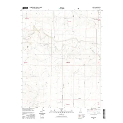
2017 Map of Sand Hill
USGS Topo · Published 2017About this map
Carrizo Creek and Garcia Cr wind through this high plains landscape in northeastern New Mexico, defining the drainage patterns of a region dominated by ranching and open range. The northeast corner of the map encompasses a portion of the Kiowa National Grassland, reflecting the federal conservation efforts that followed the Dust Bowl era. Terrain features such as the Cedar Hills, Sand Hill, and Sand Draw provide topographic relief against the grid of section lines and gravel roads. Evidence of early settlement and family legacy is found at the Thomas Cem in the southern part of the quadrangle. A network of local routes, including Old Field Rd, Russell Rd, and Jordan Rd, connects the scattered homesteads and pastures that characterize this corner of Union County.
Find a feature on this map
29 named features on this map. Tap any name to fly to it.
Don’t see what you’re looking for? This feature index may not catch every label — zoom into the map to look around manually.
Map Details
Editions of this 2017 Sand Hill Map
This is the sole edition of this map. No revisions or reprints were ever made.
Other maps of this area

1954 · Dalhart
USGS Topo · 1:250,000

1958 · Dalhart
USGS Topo · 1:250,000

1962 · Dalhart
USGS Topo · 1:250,000

1966 · Royce
USGS Topo · 1:24,000

1966 · Black Canyon
USGS Topo · 1:24,000

1966 · Tate School
USGS Topo · 1:24,000

1966 · Clapham
USGS Topo · 1:24,000

1966 · Car Top Butte
USGS Topo · 1:24,000

1966 · Sand Hill
USGS Topo · 1:24,000

1970 · Clayton
USGS Topo · 1:24,000