
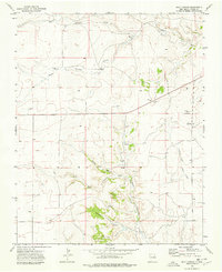
1966 Map of Black Canyon
USGS Topo · Published 1968About this map
Perico Creek and the drainage of Black Canyon define the high plains of Union County in the mid-1960s. This survey records a landscape dominated by large-scale ranching and water management, evidenced by named landmarks like Heringa Ranch and a series of livestock wells. The map reveals the critical importance of water in this semi-arid region, specifically identifying the Schoolhouse Windmill, Myers Windmill, and Bull Pasture Windmill as focal points for local navigation and land use. In the northeastern corner, the C & S railroad cuts across the terrain, providing a vital transportation link for the cattle industry. Genealogists and historians can trace property markers and family names through locations such as Comyford and the Rummel Windmill, while also noting the presence of smaller landmarks like Barbell and several Gravel Pits used for local infrastructure.
Find a feature on this map
20 named features on this map. Tap any name to fly to it.
Don’t see what you’re looking for? This feature index may not catch every label — zoom into the map to look around manually.
Map Details
Editions of this 1966 Black Canyon Map
This is the sole edition of this map. No revisions or reprints were ever made.
Other maps of this area

1954 · Dalhart
USGS Topo · 1:250,000

1958 · Dalhart
USGS Topo · 1:250,000

1962 · Dalhart
USGS Topo · 1:250,000

1966 · Royce
USGS Topo · 1:24,000

1966 · Tate School
USGS Topo · 1:24,000

1966 · Sand Hill
USGS Topo · 1:24,000

1972 · Mount Dora
USGS Topo · 1:24,000

1972 · Bible Top Butte
USGS Topo · 1:24,000

1973 · Snyder Lake
USGS Topo · 1:24,000
1973 · Goat Canyon
USGS Topo · 1:24,000