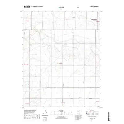
2020 Map of Sand Hill
USGS Topo · Published 2020About this map
Thomas Cem sits on the high plains of Union County, a quiet landmark within a landscape defined by the drainage of Carrizo Creek and Garcia Cr. This 2020 survey of the northeastern corner of New Mexico reveals the transition from open range to the protected boundaries of the Kiowa National Grassland. The terrain is punctuated by distinctive landforms such as the Cedar Hills and Sand Hill, which rise above the surrounding flats. A network of rural roads, including Vogle Rd and Russell Rd, connect these remote ranchlands. The presence of Sand Draw in the north indicates the intermittent water paths that shape this arid environment, providing essential context for understanding the historic and modern land use in this sparsely populated region of the state.
Find a feature on this map
29 named features on this map. Tap any name to fly to it.
Don’t see what you’re looking for? This feature index may not catch every label — zoom into the map to look around manually.
Map Details
Editions of this 2020 Sand Hill Map
This is the sole edition of this map. No revisions or reprints were ever made.
Other maps of this area

1954 · Dalhart
USGS Topo · 1:250,000

1958 · Dalhart
USGS Topo · 1:250,000

1962 · Dalhart
USGS Topo · 1:250,000

1966 · Royce
USGS Topo · 1:24,000

1966 · Black Canyon
USGS Topo · 1:24,000

1966 · Tate School
USGS Topo · 1:24,000

1966 · Clapham
USGS Topo · 1:24,000

1966 · Car Top Butte
USGS Topo · 1:24,000

1966 · Sand Hill
USGS Topo · 1:24,000

1970 · Clayton
USGS Topo · 1:24,000