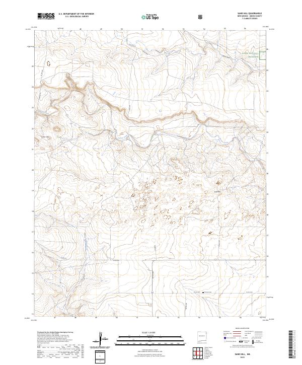
2023 Map of Sand Hill
USGS Topo · Published 2023About this map
Carrizo Creek winds through the high plains of northeastern New Mexico, defining the drainage patterns of this sparsely settled section of Union County. As a primary hydrological feature, the creek's meandering course provides a vital point of reference across a landscape dominated by open range and section-line roads. The terrain is characterized by subtle elevation changes and broad drainage basins, illustrating the enduring agricultural and ranching layout of the High Plains. This survey captures the rural character of the region, where natural watercourses like the Carrizo Creek remain central to the geography of the land, serving as both a historical and modern focal point for local land use and property boundaries.
Find a feature on this map
1 named feature on this map. Tap any name to fly to it.
Don’t see what you’re looking for? This feature index may not catch every label — zoom into the map to look around manually.
Map Details
Editions of this 2023 Sand Hill Map
This is the sole edition of this map. No revisions or reprints were ever made.
Other maps of this area

1954 · Dalhart
USGS Topo · 1:250,000

1958 · Dalhart
USGS Topo · 1:250,000

1962 · Dalhart
USGS Topo · 1:250,000

1966 · Royce
USGS Topo · 1:24,000

1966 · Black Canyon
USGS Topo · 1:24,000

1966 · Tate School
USGS Topo · 1:24,000

1966 · Clapham
USGS Topo · 1:24,000

1966 · Car Top Butte
USGS Topo · 1:24,000

1966 · Sand Hill
USGS Topo · 1:24,000

1970 · Clayton
USGS Topo · 1:24,000