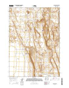
2014 Map of Sand Rock
USGS Topo · Published 2014About this map
Christmas Lake Valley and the vast drainage of Buffalo Flat characterize this high-desert landscape in Lake County, Oregon. The topography is defined by aeolian processes, visible in the extensive Sand Dunes that shift across the northern sections near Sand Rock. This arid environment, recorded in 2014, relies on a network of Bureau of Land Management routes, such as Lost Forest Ln and Buffalo Wls, which provide access through the varying elevations of the Hansen Valley. Rising above the valley floor, the prominent Fredrick Butte stands as a distinct landmark on the eastern edge of the quadrangle. The map captures a transition between low-lying alkali flats and the scrubland typical of the Oregon outback, offering a detailed view of the remote water and road infrastructure managed by federal agencies in this part of the state.
Find a feature on this map
20 named features on this map. Tap any name to fly to it.
Don’t see what you’re looking for? This feature index may not catch every label — zoom into the map to look around manually.
Map Details
Editions of this 2014 Sand Rock Map
This is the sole edition of this map. No revisions or reprints were ever made.
Other maps of this area

1955 · Crescent
USGS Topo · 1:250,000

1957 · Crescent
USGS Topo · 1:250,000

1958 · Crescent
USGS Topo · 1:250,000

1970 · Crescent
USGS Topo · 1:250,000

1981 · Fossil Lake
USGS Topo · 1:24,000

1981 · Sand Rock
USGS Topo · 1:24,000

1981 · Moonlight Butte
USGS Topo · 1:24,000

1981 · Mean Rock Well
USGS Topo · 1:24,000

1981 · Elk Butte
USGS Topo · 1:24,000

1981 · Chicago Valley
USGS Topo · 1:24,000