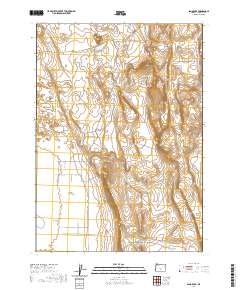
2020 Map of Sand Rock
USGS Topo · Published 2020About this map
Christmas Lake Valley and the expansive basin of Buffalo Flat dominate this portion of the high desert in Lake County. This area is characterized by a sparse network of Bureau of Land Management routes, including the prominent north-south Buffalo Wells Rd and Hanson Valley Rd, which provide access through the sagebrush and scrub. These roads follow the natural contours between topographic elevations such as Sand Rock and the northern edge of Pine Ridge. The transition into Hansen Valley at the southern margin reflects a landscape primarily shaped by public land management and high-altitude basins. Local history and genealogy researchers may find the specific alignment of these BLM access roads useful for identifying land use patterns and historical access points to the interior of the valley.
Find a feature on this map
20 named features on this map. Tap any name to fly to it.
Don’t see what you’re looking for? This feature index may not catch every label — zoom into the map to look around manually.
Map Details
Editions of this 2020 Sand Rock Map
This is the sole edition of this map. No revisions or reprints were ever made.
Other maps of this area

1955 · Crescent
USGS Topo · 1:250,000

1957 · Crescent
USGS Topo · 1:250,000

1958 · Crescent
USGS Topo · 1:250,000

1970 · Crescent
USGS Topo · 1:250,000

1981 · Fossil Lake
USGS Topo · 1:24,000

1981 · Sand Rock
USGS Topo · 1:24,000

1981 · Moonlight Butte
USGS Topo · 1:24,000

1981 · Mean Rock Well
USGS Topo · 1:24,000

1981 · Elk Butte
USGS Topo · 1:24,000

1981 · Chicago Valley
USGS Topo · 1:24,000