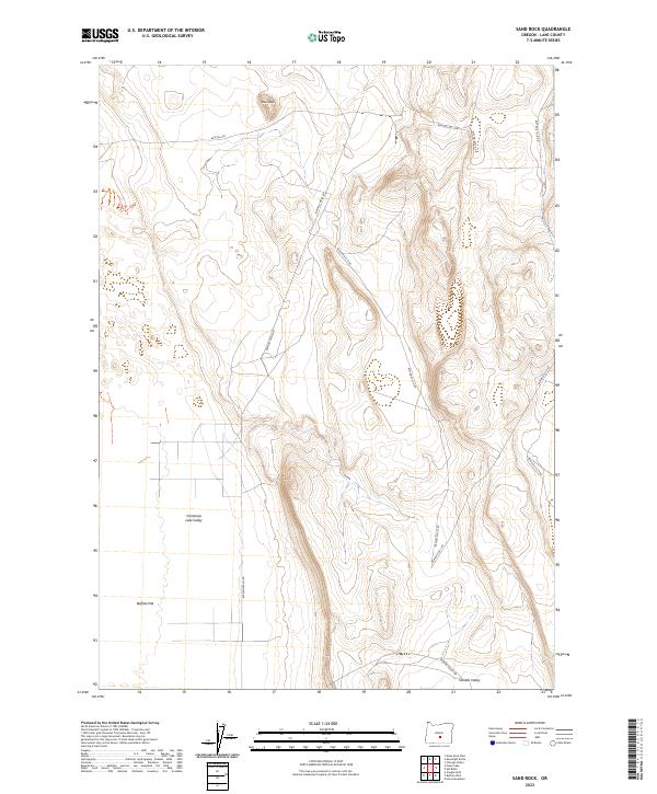
2023 Map of Sand Rock
USGS Topo · Published 2023About this map
Sand Rock rises as a prominent landmark within the high desert landscape of Lake County, overlooking a network of dry basins and managed resource roads. The area is defined by the broad expanses of Christmas Lake Valley and Buffalo Flat, where the lack of perennial surface water has historically dictated the patterns of settlement and ranching. Access throughout the territory is provided by an extensive system of Bureau of Land Management routes, including the prominent Buffalo Wells Rd, which connects these arid flats. To the south, the terrain descends toward Hansen Valley, where the Hanson Valley Rd skirts the base of the surrounding uplands. This map documents a remote section of the Oregon outback where the Public Land Survey System grid, marked by sections like t26s r20e, remains the primary framework for navigating the vast, unpopulated terrain.
Find a feature on this map
19 named features on this map. Tap any name to fly to it.
Don’t see what you’re looking for? This feature index may not catch every label — zoom into the map to look around manually.
Map Details
Editions of this 2023 Sand Rock Map
This is the sole edition of this map. No revisions or reprints were ever made.
Other maps of this area

1955 · Crescent
USGS Topo · 1:250,000

1957 · Crescent
USGS Topo · 1:250,000

1958 · Crescent
USGS Topo · 1:250,000

1970 · Crescent
USGS Topo · 1:250,000

1981 · Fossil Lake
USGS Topo · 1:24,000

1981 · Sand Rock
USGS Topo · 1:24,000

1981 · Moonlight Butte
USGS Topo · 1:24,000

1981 · Mean Rock Well
USGS Topo · 1:24,000

1981 · Elk Butte
USGS Topo · 1:24,000

1981 · Chicago Valley
USGS Topo · 1:24,000