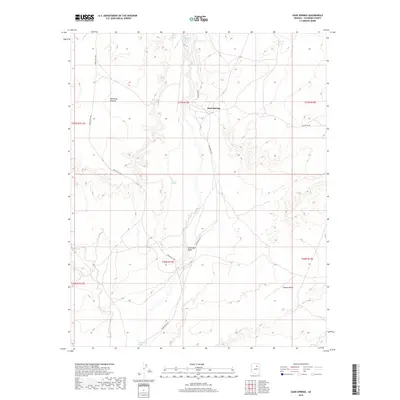
2018 Map of Sand Springs
USGS Topo · Published 2018About this map
Moenkopi Plateau dominates the northwestern landscape of this Coconino County region, transitioning into the expansive elevations of Garces Mesas to the south. The arid terrain is defined by its intermittent water sources, notably the Dinnebito Wash and Saltwater Wash, which carve drainage patterns across the high desert. At the center of this network lies Sand Springs, a critical focal point for local navigation and water access in a territory where isolated features like Whisky Spring, Drag Spring, and Tishepi Spring serve as essential landmarks. This area is characterized by a sparse but vital infrastructure of Bureau of Indian Affairs routes, including Indian Rte 58 and Indian Rte 6721, which provide the primary transit through the extensive townships and ranges of the Navajo Nation.
Find a feature on this map
17 named features on this map. Tap any name to fly to it.
Don’t see what you’re looking for? This feature index may not catch every label — zoom into the map to look around manually.
Map Details
Editions of this 2018 Sand Springs Map
This is the sole edition of this map. No revisions or reprints were ever made.
Other maps of this area

1883 · Tusayan
USGS Topo · 1:250,000

1886 · Tusayan
USGS Topo · 1:250,000

1886 · San Francisco Mtns
USGS Topo · 1:250,000

1891 · San Francisco Mtns
USGS Topo · 1:250,000

1894 · San Francisco Mtns
USGS Topo · 1:250,000

1899 · San Francisco Mtns
USGS Topo · 1:250,000

1947 · Flagstaff
USGS Topo · 1:250,000

1954 · Flagstaff
USGS Topo · 1:250,000
1955 · Black Falls 4 SE
USGS Topo · 1:24,000

1958 · Flagstaff
USGS Topo · 1:250,000