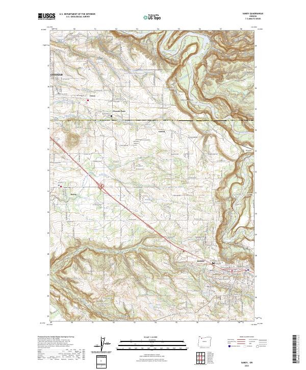
2023 Map of Sandy
USGS Topo · Published 2023About this map
The Sandy Wild and Scenic River carves a deep, winding corridor through the landscape, defining the northern and eastern reaches of this modern topographical study. The terrain transitions from the lower elevations near Gresham and Boring into the higher, more complex topography surrounding the city of Sandy. This area serves as a primary gateway to the mountains, characterized by a dense network of local roads such as SE Dodge Park Blvd and SE Gordon Creek Rd that navigate the ridges between numerous watercourses.
Find a feature on this map
152 named features on this map. Tap any name to fly to it.
Don’t see what you’re looking for? This feature index may not catch every label — zoom into the map to look around manually.
Map Details
Editions of this 2023 Sandy Map
This is the sole edition of this map. No revisions or reprints were ever made.
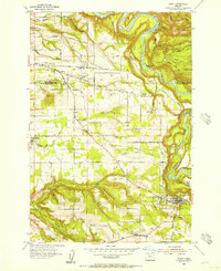
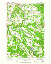
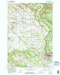
Historical Maps of Pleasant Home Through Time
4 maps found