Old Maps of Sandy, Oregon
Explore 25 old maps of Sandy, spanning from 1911 to today. These high-resolution historic maps reveal how streets, neighborhoods, landmarks, and natural features evolved over time — perfect for genealogy, metal detecting, research, and local history exploration.
What you can do with these maps:
- See how Sandy changed over time: Compare historical maps to modern-day views to trace roads, homesites, rail lines & more.
- View detailed metadata: Each map includes creators, publishers, year, scale, and archive source.
- Overlay maps with satellite & LiDAR: Visualize the past alongside modern tools to explore terrain & human change.
- Trusted historical sources: Maps sourced from the USGS, Library of Congress, and other archives.
- Access maps your way: View online, download high-res files, or order prints for personal or research use.
Start exploring old maps of Sandy to uncover forgotten places, hidden landmarks, and the deep history beneath your feet.
Sandy, OR maps
(25)- 1911 Map of Boring
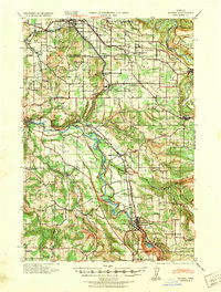
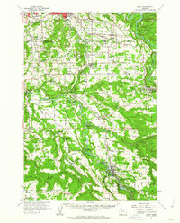
 1911 Boring1911 Print · USGSClackamas County was a patchwork of small farming communities and emerging rail hubs in the decade before the First World War. Researchers can trace the early footprints of settlements like Boring and Gresham, alongside family landmarks such as Peterson Crossroads and Sycamore School.
 - 1914 Map of Boring
 1914 Boring1914 Print · USGSThe Clackamas River valley was a hub of early twentieth-century logging and electric rail expansion between Gresham and Estacada. Genealogists and historians can trace defunct river crossings like McMurray Ferry and rural landmarks such as Fishers Mill and Stone School.3 unique versions available
 - 1916 Map of Estacada
 1916 Estacada1916 Print · USGSClackamas County is captured here during a period of rapid hydroelectric and rail development just before the First World War. Researchers can trace early family homesteads near Fishers Mill, the old Feldbimer Ferry crossing, and the rail line serving Boring and Estacada.5 unique versions available
 - 1940 Map of Boring
 1940 Boring1940 Print · USGSClackamas and Multnomah Counties are captured in the late thirties, documenting a landscape shaped by the Clackamas River and electric rail lines. Trace the route of the Cazadero Line or locate family roots at Mt Zion Cem and Lusted School.
 - 1948 Map of Vancouver, 1957 Print
 1948 Vancouver1957 Print · USGSPost-war growth transforms the river valleys of the Pacific Northwest as the timber and rail economy thrives. Trace family roots in Tillamook or Oregon City, and locate vanished landmarks like the spit at Bayocean or the Skamania Mine.
 - 1950 Map of Vancouver
 1950 Vancouver1950 Print · USGSCoastal Oregon and the lower Columbia River valley are captured in detail just after the war. Researchers can trace historic rail routes like the Southern Pacific or locate early settlements such as Vernonia, Gaston, and the Grand Ronde Indian Reservation.
 - 1950 Map of Vancouver, 1951 Print
 1950 Vancouver1951 Print · USGSThe Pacific Northwest urban corridor meets the rugged coast in the years following the war, showing the expansion of Portland and Vancouver. Genealogists and historians can trace the reach of the Southern Pacific RR and locate coastal communities like Tillamook, Seaside, and Tolovana Park.
 - 1954 Map of Sandy, 1956 Print
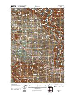
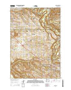
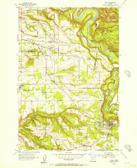 1954 Sandy1956 Print · USGSThe foothills of the Cascades meet the Clackamas County farm country in the mid-fifties, showing a landscape defined by deep creeks and the Sandy River. Researchers can trace old family lands near Pleasant Home, Cottrell, and the State Fish Hatchery.
 - 1955 Map of Cherryville, 1957 Print
 1955 Cherryville1957 Print · USGSClackamas County in the mid-fifties is defined by its transition from the agricultural valleys near Cherryville to the timbered heights of the Mount Hood National Forest. Genealogists can locate family landmarks like Porter School and Camp Namanu or trace the early path of Highway 26 through Brightwood.3 unique versions available
 - 1958 Map of Vancouver, 1968 Print
 1958 Vancouver1968 Print · USGSThe Lower Columbia and Willamette valleys thrive in the late sixties as major rail and river hubs. Genealogists and historians can trace the development of Portland, identify the grounds of Camp Withycombe, and locate coastal landmarks from Tillamook Head to Garibaldi.3 unique versions available
 - 1961 Map of Sandy
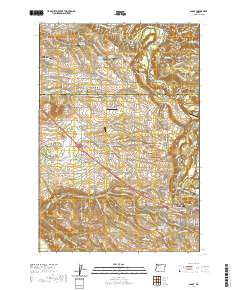
 1961 Sandy1961 Print · USGSThe Clackamas and Multnomah County line during the early sixties shows a landscape of growing rural communities and deep river valleys. Genealogists and local historians can locate specific family-named roads and landmarks like Cottrell School, the Fish Hatchery, and the town of Boring.6 unique versions available
 - 1961 Map of Sandy, 1962 Print
 1961 Sandy1962 Print · USGSClackamas County was a landscape of river-driven industry and rural crossroads in the early sixties. Researchers can trace historic river crossings at the Feldheimer Ferry (Site), find the Fischers Mill site, and locate early schools like Damascus Union Sch.
 - 1964 Map of Vancouver
 1964 Vancouver1964 Print · USGSThe Pacific Northwest interior and coast are shown here in the 1960s, from the Portland metropolitan hub to the rugged Pacific shoreline. Researchers can trace the legacy of the Grand Ronde Indian Reservation, the early layout of McMinnville, and the maritime approaches near Tillamook Head.
 - 1982 Map of Oregon City, 1983 Print
 1982 Oregon City1983 Print · USGSGreater Portland and the Willamette Valley are shown in the early eighties as the region's urban and rural landscapes converged. Genealogists and historians can trace family-named sites across French Prairie, visit St Paul Ch, or locate the grounds of Dammasch State Hospital.
 - 1985 Map of Bull Run, 1986 Print
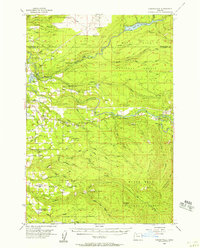
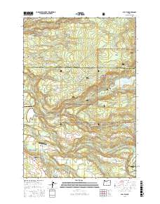
 1985 Bull Run1986 Print · USGSClackamas County was a hub of water management and rural settlement in the mid-1980s, centered on the protected forest watersheds. Researchers can trace the layout of historic sites like Bull Run, the local Cem, and recreational landmarks such as Camp Namanu.2 unique versions available
 - 1997 Map of Bull Run, 1999 Print
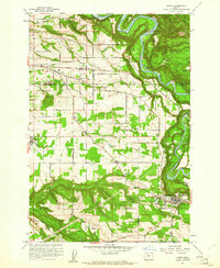
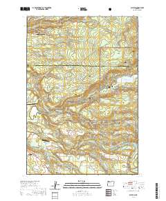
 1997 Bull Run1999 Print · USGSThe Sandy River basin and the protected Bull Run highlands are captured here in the late 1990s, showcasing a landscape defined by water management and forest terrain. Genealogists and historians can trace old sites like the Bull Run (Site), Camp Namanu, and the FLUME system connecting Roslyn Lake.
 - 2011 Map of Bull Run, 2011 Print
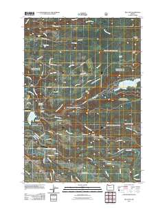 2011 Bull Run2011 Print · USGSCovers Sandy, including Multnomah County, Clackamas County, and other nearby areas
 - 2011 Map of Sandy, 2011 Print
 2011 Sandy2011 Print · USGSCovers Sandy, including Gresham, Boring, and other nearby areas
 - 2014 Map of Bull Run, 2014 Print
 2014 Bull Run2014 Print · USGSCovers Sandy, including Multnomah County, Clackamas County, and other nearby areas
 - 2014 Map of Sandy, 2014 Print
 2014 Sandy2014 Print · USGSCovers Sandy, including Gresham, Boring, and other nearby areas
 - 2017 Map of Bull Run, 2017 Print
 2017 Bull Run2017 Print · USGSCovers Sandy, including Multnomah County, Clackamas County, and other nearby areas
 - 2020 Map of Sandy, 2020 Print
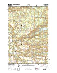
 2020 Sandy2020 Print · USGSCovers Sandy, including Gresham, Boring, and other nearby areas
 - 2020 Map of Bull Run, 2020 Print
 2020 Bull Run2020 Print · USGSCovers Sandy, including Multnomah County, Clackamas County, and other nearby areas
 - 2023 Map of Sandy, 2023 Print
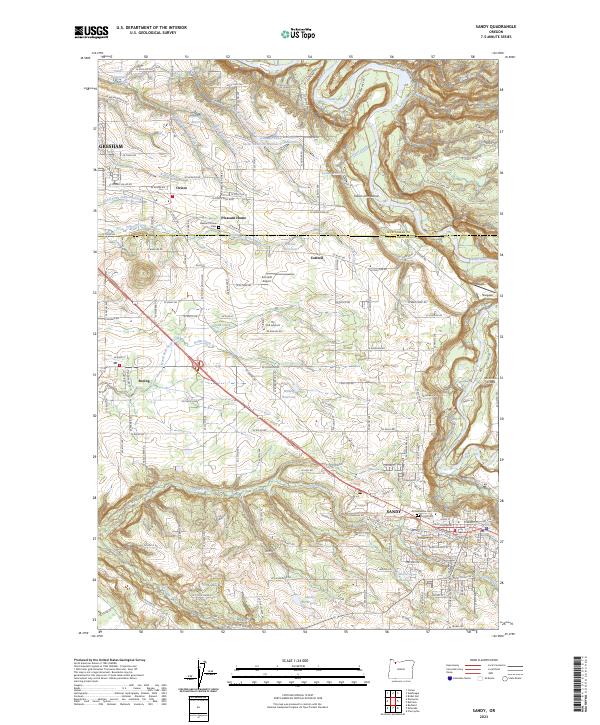 2023 Sandy2023 Print · USGSThe area between Gresham and Sandy comes into focus in the early 2020s, showing the intersection of rural heritage and modern growth. Genealogists and historians can locate the Scandinavian Cem, trace the course of Tickle Creek, and explore the community of Boring.
 - 2023 Map of Bull Run, 2023 Print
 2023 Bull Run2023 Print · USGSNortheastern Clackamas County appears in this recent survey at the edge of the Cascades. Genealogists and researchers can trace local family legacies at the Lowe Family Cemetery, Cliffside Cemetery, and the Eldridge J Broussard Junior Grave.
End of results
Showing maps 1-25 of 25
Top cities near Sandy
- Portland historical maps
- Vancouver historical maps
- Gresham historical maps
- Camas historical maps
- Happy Valley historical maps
- Springdale historical maps
See more
Frequently asked questions
- What are the different types of historical maps available for Sandy?
- What is the oldest map of Sandy?
- Where can I purchase historical maps of Sandy for my home or office?
- Where can I download high-res historical maps of Sandy?
- Are there historical topographic maps available for Sandy?
- Is there historical aerial imagery available for Sandy?
- Where are historical maps of Sandy sourced from?