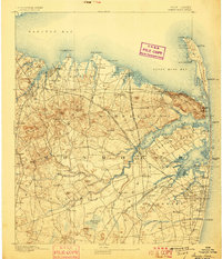
1893 Map of Sandy Hook
USGS Topo · Published 1898About this map
The Highlands of Navesink dominate the coastline of this late nineteenth-century survey, providing a natural vantage point over Sandy Hook Bay and the Atlantic. Along the peninsula, a series of maritime landmarks including the Sandy Hook Light, Waycake Light, and numerous Life Saving stations such as L.S. Station Seabright reflect the area's critical role in coastal navigation. Inland, the landscape is defined by the winding course of the Navesink River and the Swimming River, which drain the agricultural and milling districts near Tinton Falls and Leedsville.
Find a feature on this map
123 named features on this map. Tap any name to fly to it.
Don’t see what you’re looking for? This feature index may not catch every label — zoom into the map to look around manually.
Map Details
Editions of this 1893 Sandy Hook Map
2 editions found
Other maps of this area

1888 · Plainfield
USGS Topo · 1:62,500

1888 · New Brunswick
USGS Topo · 1:62,500

1888 · Asbury Park
USGS Topo · 1:62,500

1888 · Cassville
USGS Topo · 1:62,500

1888 · Sandy Hook
USGS Topo · 1:62,500

1889 · Brooklyn
USGS Topo · 1:62,500

1891 · Brooklyn
USGS Topo · 1:62,500

1893 · New Brunswick
USGS Topo · 1:62,500

1893 · Plainfield
USGS Topo · 1:62,500

1893 · Sandy Hook
USGS Topo · 1:62,500